Projects

  • Close Liaison with Local Authority and NHBC Saves Time and Money

    Ruddlesden geotechnical often liaise with the local authority’s environmental health officer (EHO) and, in some instances, the petroleum officer to gain additional background information about a site. The local authority often have additional information or insight as a result of previous developments within the same area. Ruddlesden geotechnical held favourable discussions with both the EHO and warranty provider (NHBC) regarding the risk of ground gases (carbon dioxide and methane) to a proposed residential development site in Shrewsbury, Shropshire. Initially, the warranty provider felt that in-situ ground gas monitoring was required to ascertain the risk of gases migrating from a nearby landfill site to beneath the site. However, following joint discussions with the EHO, it transpired that historical ground gas monitoring, both on and off the landfill, had shown that the landfill had a relatively low ground gas generation potential and so was unlikely to significantly affect the site. It was agreed that in lieu of in-situ monitoring, nominal ground gas protective measures, akin to full radon protective measures (a gas proof membrane and subfloor ventilation), could be adopted. On this occasion, this pragmatic approach saved the developer significant time and money.

  • Ground Conditions Chapter for Environmental Statement for Large Residential Development

    Ruddlesden geotechnical produced a ground conditions chapter for an Environmental Statement (ES) as part of the Environmental Impact Assessment (EIA) for a new, large residential development on the outskirts of Dawlish, Devon. Following the scoping assessment, which was agreed between Ruddlesden and the local authority, a Phase 1 Preliminary Geotechnical and Contamination Assessment was undertaken to provide information on the baseline ground conditions at the site. This information was used to assess how the proposed development would affect the ground conditions in the short term (construction stage) and long term (developed stage). Where the proposals were found to have a negative impact on the baseline ground conditions, mitigation measures were proposed to reduce the impact to acceptable levels.

  • 65-definition-of-waste-development-industry-code-of-practice-2

    Materials Management Plan Avoids Unnecessary Landfill Disposal

    Ruddlesden geotechnical produced a Materials Management Plan (MMP) in accordance with CL:AIRE Definition of Waste (DoW): Code of Practice (CoP) for the movement of topsoil from a greenfield site undergoing development near Exeter (donor site), to a new visitor centre on the Jurassic Coast (receiver site). The production of the MMP ensured that good quality topsoil was not unnecessarily taken to landfill and certified that the topsoil was of sufficient quality and suitable for use to be placed in the areas of public open space surrounding the visitor centre. The liaison between Ruddlesden geotechnical, the client, the donor site, the haulage contractor and the Environment Agency were key to ensure that the MMP was in place in a timely manner, prior to material movements. Following the movement of the topsoil, a validation report was produced to demonstrate that the material movements had taken place in accordance with the MMP, to the satisfaction of the Environment Agency.

  • 64-foundation-works-risk-assessments-1

    Foundation Works Risk Assessment Allows Development to Proceed

    Ruddlesden geotechnical were commissioned to undertake a Foundation Works Risk Assessment for a proposed commercial development within the centre of Cirencester. The development was to include the installation of piled foundations to support the proposed buildings. The Environment Agency were concerned that the installation of the piled foundations could mobilise contaminants within an overlying thickness of made ground into the underlying Secondary A Aquifer (Forest Marble Formation) and potentially cause contamination to the water environment. Ruddlesden produced a Foundation Works Risk Assessment in accordance with the Environment Agency’s published guidance document. This included the production of a detailed conceptual site model (CSM) and identifying the potential scenarios and pollutant linkages that could occur as a result of the piling works. The risk assessment suggested that the piling contractor’s chosen piling method could foreseeably cause contamination of the underlying aquifer, as a result of displacing/ pushing contaminated soils down into it. Following the risk assessment, an alternative (non-displacement/ replacement) method of piling was proposed which would mitigate the risks of contaminating the underlying aquifer. This risk assessment was approved by the Environment Agency and local authorityand allowed the works to continue as proposed.

  • 62-supervision-of-remediation-works-3

    Supervision of Contamination Remediation of Former Petrol Filling Station

    Ruddlesden geotechnical recently supervised the contamination remediation works for residential development of a former petrol filling station site in Exeter. Ruddlesden supervised the excavation of the underground fuel storage tanks, pipelines and interceptors, as well as grossly contaminated soils. Validation testing of the resultant excavations was subsequently undertaken, to demonstrate that no unacceptable levels of contamination remained in the ground. Groundwater quality monitoring in borehole installations was also undertaken before, during and after the remedial works, to assess the risks to controlled waters and a betterment of groundwater quality. Close liaison throughout the works with the local authority and Environment Agency, ensured that the regulators were satisfied with the works and all the relevant planning conditions were discharged.

  • 62-supervision-of-remediation-works-1

    Validation Testing in Somerset to Satisfy NHBC and Local Authority

    Ten years after carrying out the original contamination investigation and assessment, Ruddlesden geotechnical returned to the site to carry out the validation testing of the remedial works. The validation testing included hand-excavated trial pits in garden areas, to obtain samples for laboratory testing to confirm the cleanliness of the capping soil in garden areas and to provide a photographic record of the depth of the capping layer, as well as documentary evidence of the gas protection measuresand upgraded water supply pipes. The site visit was attended promptly and the laboratory testing was expedited, following which the report was issued without delay, to ensure they were no problems with sales.

  • 61-contamination-remediation-strategy-1

    Contamination Remediation Strategy Outlines Requirements for Residential Development

    In order to satisfy a planning and NHBC land quality conditions, Ruddlesden produced a contamination remediation method statement, which summarised the contamination risks across the site and set out a clear and structured approach for remediating the site for the developer, to satisfy regulators and warranty providers. Ruddlesden geotechnical had previously undertaken a Phase 1 and Phase 2 contamination investigation and assessment, which had indicated that the site was covered by surficial thicknesses of made ground containing loose fibres of chrysotile asbestos. Additionally, several underground fuel storage tanks and a historical air raid shelter, filled with asbestos containing materials (ACMs). The remediation strategy included excavation and removal of the underground fuel storage tanks and ACM, to be undertaken by licensed contractors, together with capping of garden areas with 600mm of clean soil underlain by a geotextile membrane. The remediation strategy also outlined the validation testing requirements, which were subsequently undertaken by Ruddlesden geotechnical.

  • 60-fuel-oil-csm-1

    TPH, PAH, VOC and SVOC Testing for Contamination Risk Assessments

    Extensive speciated total petroleum hydrocarbon (TPH), polyaromatic hydrocarbon (PAH), volatile organic compound (VOC) and semi-volatile organic compound (SVOC) soil and groundwater testing was undertaken as part of the contamination investigation and assessment for a former railway station and bitumen emulsion depot in Somerset. The locations of the samples and suites of the laboratory testing were targeted, based on the conceptual site model (CSM) and site observations. The laboratory testing was supplemented with in-situ VOC testing using a photo-ionisation detector (PID). The results of the laboratory testing, which was UKAS accredited, were used as part of the human health and controlled waters risk assessments, so that appropriate remedial measures could be provided. All of the analysis and reports were approved by the local authority, NHBC and Environment Agency.

  • 59-heavy-metal-testing-cornwall-1

    Iron and Manganese Testing undertaken Instead of Remediation

    An effervescent (oily) and rusty sheen was noted on water within initial foundation excavations and concern was raised about possible contamination from a nearby former railway siding. A walkover survey and geological knowledge identified the effervescent and rusty sheen as being of natural origin. Some bacteria (leptothrix discophora) that live in waterlogged places get their energy from iron and manganese, and, as these harmless bacteria grow and decompose, the iron may appear oily or form red or orange films, fluffs and coatings. It was also noted that a mining report stated that mines in the area were mainly mined for manganese, i.e. the underlying geology is rich in manganese. Therefore, no remedial measures were required. This was confirmed by UKAS accredited contamination laboratory testing.

  • 58-asbestos-testing-reduced-1

    Asbestos Testing Allays the Concerns of Locals

    As part of a larger contamination investigation and assessment for the residential development of a former power station, asbestos testing was undertaken. Anecdotally, asbestos containing materials (ACMs) arising from the decommissioning of the former power station had been encapsulated in a buried concrete chamber. Concerns were raised by locals and the local authority about how safe this was and whether the proposed development would endanger the general public, end users and construction workers. Intensive asbestos investigation and assessment, undertaken in accordance with the Control of Asbestos Regulations (CAR, 2012) and which included asbestos quantification testing, identified that the proposed remedial strategy to mitigate other contaminants at the site, which included raising the site levels and capping with inert soil, would also protect from the low levels of asbestos recorded in the soil., with no further measures required protect end users. The asbestos testing also enabled safe methods of working to be determined for construction workers.

  • 57-waste-classification-1

    Correct Waste Classification Saves Costs

    Waste classification was undertaken on surplus soil at a residential development site in Exeter. The soil had been purchased and imported to be used as capping beneath road surfaces for the new development. However, the material was later found to be unsuitable for the proposed use. The soil had initially been classified by others as hazardous waste, due to the presence of loose asbestos fibres within the soil matrix. However, following intensive (and representative) sampling of the soil stockpiles, Ruddlesden geotechnical were able to confirm that the soil was non-hazardous waste. Classifying the waste properly, in accordance with Environment Agency guidance, saved the client significant costs, which would have been incurred if the soil were to have been taken to a hazardous waste landfill, as was originally proposed.

  • 56-ukwir-water-pipe-assessment-1

    Water Supply Pipe Assessment for Residential Development

    Ruddlesden geotechnical were commissioned to undertake a preliminary site assessment report for water supply pipe selection at a proposed residential development site in North Devon. The desk study indicated that the site had had no previous development and had not been used for the storage of fuels or chemicals. The report, which was undertaken in accordance with UKWIR guidance, concluded that no special requirements were required for water supply pipes at this site.

  • BR 211 Radon Protection Measures

    Radon Protection General Requirements

    Although outside the scope of services usually provided, Ruddlesden geotechnical were able to help with a recent enquiry from a private individual. Whilst the details would need to be designed by a suitably qualified engineer, Ruddlesden were able to confirm the general principles of radon protection in ground floor slab construction, with reference to BRE Report BR211 (2023 edition): Radon: Guidance on Protective Measures for New Buildings (including supplementary advice for extensions, conversions and refurbishment projects). All staff are very familiar with this document as, given the company’s location in southwest England, where elevated levels of naturally occurring radon are commonly present, due the underlying geology, almost all geotechnical and contamination reports include a radon assessment.

  • 55-ground-gas-assessment-reduced-1

    Ground Gas Assessment for Large Residential Development Site

    After completing a Phase 1 contamination assessment, Ruddlesden were instructed to undertake a ground gas risk assessment for a proposed residential development near Rugby. The southern and western boundaries of the site were bordered by an active landfill site and historical landfilling activities had taken place within the southwest of the site. Twelve ground gas monitoring wells were installed to varying depths within the confines of the proposed residential development site. The wells were monitored on twelve occasions following installation with a landfill gas analyser, for oxygen, methane, carbon dioxide and gas flow. Atmospheric pressure and other environmental conditions were also recorded. The results of the monitoring were used to produce a gas screening value (GSV), which was used in the assessment to ascertain whether any protective measures were required for new dwellings. The results indicated that a suitably installed gas proof membrane and subfloor ventilation would provide sufficient protection against the levels of ground gas present.

  • 53-controlled-waters-risk-assessment-1

    P20 Groundwater Risk Assessment Demonstrates No Remediation Required

    At a former engineering works near Exeter, elevated levels of polyaromatic hydrocarbons (PAH) and total petroleum hydrocarbons (TPH) were recorded in both the soil and groundwater beneath the site. As screening criteria had been exceeded in the groundwater beneath the site for these contaminants, further assessment was required to ascertain whether the recorded levels of contaminants beneath the site could migrate to off-site receptors, e.g. to a nearby river, and cause unacceptable levels of pollution to the water environment. Remedial targets were calculated using the Environment Agency’s Remedial Targets Worksheet (P20 assessment). In this instance, the recorded values were below the calculated remedial targets and the risk assessment demonstrated that unacceptable pollution was unlikely to occur to controlled waters, as the levels of contaminants on-site were modelled to have diluted by natural attenuation and dispersion processes before reaching the receptor. No further assessment or remedial works were considered to be necessary. This was agreed with and accepted by the Environment Agency.

  • 52-dqra-1

    Bioaccessibility Testing Negates Remediation

    The chemical laboratory test results obtained as part of a Phase 2 contamination investigation for a proposed residential development in South Devon indicated elevated levels of arsenic to be present in natural soils. A generic qualitative risk assessment (GQRA) showed that all the recorded levels of arsenic exceeded the generic assessment criteria (GAC), indicating that remediation or further assessment was required. Based on the conceptual site model (CSM), as no significantly elevated levels of contamination were expected, but given the underlying geology naturally elevated levels of metals and metalloids may be present, it was considered that further assessment should be undertaken instead of remediation. A detailed quantitative risk assessment (DQRA) was therefore carried out, including additional bioaccessibilitytesting, as the GAC to which the recorded levels of arsenic were initially compared assumes that 100% of the arsenic is bioaccessible, whereas naturally occurring elements are typically not 100% bioaccessible. The bioaccessibility test is a laboratory test that simulates conditions in the gastrointestinal tract to assess the human bioaccessibility of potentially harmful elements by ingestion. As the ingestion pathway is the primary migration pathway for arsenic, the bioaccessibility significantly affects the assessment criteria. The results of the bioaccessibility testing were incorporated into the CLEA, in which the end users were also modified, as the proposed development was for a residential care home rather than a standard residential land use, to produce a site-specific assessment criterion, which was greater than all of the recorded levels of arsenic. It was therefore concluded that the recorded levels of arsenic were not likely to be harmful to end users, given the proposed end use, and that no remediation was necessary. Carrying out this further testing and detailed quantitative risk assessment (DQRA) avoided the need to carry out unnecessary remediation.

  • 51-human-health-risk-assessment-1

    Residential Redevelopment of Former Garage

    A human health risk assessment at a proposed residential development site in North Devon was undertaken as part of a wider scope of works comprising a Phase 1 and Phase 2 contamination assessment, followed by the production of a remediation strategy and subsequent validation testing. The Phase 1 assessment indicated that the site was a former garage, part of a larger historical coach depot. The Phase 2 contamination investigation, which comprised windowless sample boreholes and contamination laboratory testing, recorded elevated levels of total petroleum hydrocarbons (TPH)and lead within both made ground and underlying natural soils, associated with a remnant underground storage tank (UST), fuel lines and an off-site tank, within the confines of the former coachworks. The contamination risk assessment indicated the recorded levels of contamination to potentially be harmful to human health, given the proposed residential land use. To protect end users, Ruddlesden recommended that all of the tanks and associated fuel lines be remove, and that all proposed garden/ soft-landscaped areas be capped with a minimum thickness of 600mm topsoil and subsoil underlain by a geotextile membrane. All of Ruddlesden’s reports were approved by the local authority’s environmental health officer and the contaminated land planning condition was satisfied.

  • 50-phase-1-contamination-assessment-1

    Pre-Purchase Phase 1 Contamination Assessment

    Phase 1 Contaminated Land Assessment for the proposed redevelopment of a brownfield site in Devon, as part of the pre-purchase appraisal for the construction of a new supermarket. The site had numerous historical industrial land uses, including an iron foundry, gas works and an engineering works, as well as documented evidence of historical contamination of the ground, associated with an adjacent gas works. The production of the Phase 1 was crucial to understanding the potential development (and cost) constraints at this site for the client, prior to purchasing, and formed the basis of the scope of works for the Phase 2 Contamination Investigation.

  • 49-contamination-risk-assessment-reduced-1

    Multiple Contamination Assessment and Consultancy Services at Holiday Park, Cornwall

    A full range of contamination investigation and assessment services have been provided for a large and on-going holiday accommodation development in Cornwall. The Phase 1 Contamination Assessmentidentified that much of the site was underlain by a former licensed and unlicensed landfill site. The dynamic sampling/ windowless sample boreholes and trial pits, together with contamination laboratory testing, identified the site to be underlain by made ground/ fill, most of which comprised locally derived soil with no significantly elevated levels of contamination; however, localised areas of elevated levels of contamination were identified. A detailed quantitative risk assessment (DQRA) was undertaken, which included bioaccessibility testing and modifying the exposure duration within the CLEA model, to demonstrate that whilst some of the recorded levels of contamination might exceed the generic assessment criteria (GAC) for a standard residential land use, the recorded levels of contamination were unlikely to be harmful to human healthgiven the proposed end use. Particularly high levels of ground gas (methane and ground gas) have been recorded. Long-term gas monitoring and a large dataset has been required to undertake a robust ground gas assessment, where peak and steady flow rates and maximum concentrations, together with groundwater level and atmospheric pressure fluctuations, have been studied in detail to ensure the correct site characterisation and gas protection measure proposals. Continuous client and local authority engagement together with clear reporting have been crucial at this site to ensure that relatively complex issues were understood by all and the relevant planning conditions have been discharged.

  • Ground Investigation Report, Cornwall

    A Ground Investigation Report, fulfilling the requirements set out in BS EN 1997-2: Ground Investigation & Testing, was produced for an extension to a school in Dorset. The Ground Investigation Report (GIR) presented a factual record of the ground and groundwater conditions encountered, together with the laboratory testingresults, followed by a review of the ground profile and geotechnical parameters for foundation design. The Ground Investigation Report was issued promptly, shortly after the receipt of the laboratory testing results, less than three weeks after the completion of siteworks. Interim parameters for design were provided prior to the receipt of the laboratory testing results, based on field observations and in-situ testing results.

  • Mineral Resource Assessments, Dorset

    Mineral Resource Assessments have been undertaken for three sites in close proximity to each other for the same developer on the outskirts of village near Poole, in Dorset, where minerals resource assessments are commonly required due to the quarrying of sand and gravel deposits. Ruddlesden geotechnical carried out site-specific desk-based assessments of the superficial and bedrock geology and potential mineral resources, including the study of geological maps and memoirs, historical data, nearby borehole records, site investigation reports and British Geological Survey Mineral Resource Information for Development Plans. The mineral resource assessments, which were undertaken at the pre-application planning stage, as part of the viability assessment, identified that deposits beneath two of the sites were unlikely to be quarried, whereas further work was required to assess the risks at the third site. This information was used by the developer to help prioritise the developments.

  • Pile Mat Design, Plymouth

    Geogrids were used as part of a pile mat design for a site in Plymouth. Calculations, which were undertaken in accordance with BRE 470: working Platforms for Tracked Plant, showed that a significant reduction in the platform thickness could be achieved if geogrid was incorporated into the platform construction, reducing the temporary works costs. Calculations were carried out for geogrids of varying tensile strength so that cost-benefit analyses could be carried out.

  • 46-ground-improvement-reduced-1

    Ground Improvement, Shropshire

    To inform the design of an embankment for a proposed highway, as part of the residential redevelopment of a site in Shropshire, Ruddlesden geotechnical were instructed to undertake a geotechnical investigation and assessment. The geotechnical investigation comprised cable percussive boreholes, which encountered a succession of Alluvial soils, including peat, silt and clay to depths in excess of 10m depth. Analyses indicated that the surcharge of the embankment would consolidate the underlying soils by virtue of their low strength, which would likely affect the serviceability of the proposed highway. It was also considered that there would be an insufficient factor of safety on the global stability of the embankment. Ruddlesden geotechnical proposed that ground improvement be undertaken, for example by pre-surcharging the ground and installing drainage, to speed-up the consolidation of the underlying Alluvial soils, to reduce the amount of anticipated settlement in the long term to acceptable levels.

  • 45-earthworks-specification-reduced-1

    Earthworks Specification, Devon

    Following a materials suitability assessment, Ruddlesden geotechnical produced an earthworks specification for the proposed material movements at a residential development site in Paignton. The specification summarised suitable and unsuitable materials present (based on the findings of the materials suitability assessment) and provided details of how to excavate, stockpile and deposit the materials. Guidance on the testing requirements (to confirm the material was suitable for placement/ conformed to those suitable materials detailed within the specification) was also provided. Ruddlesden geotechnical also carried out the earthworks testing for this project.

  • 44-earthworks-materials-suitability-assessment-1

    Earthworks Materials Suitability Assessment Enables Re-Use of Site-Won Soils, Devon

    A materials suitability assessment was undertaken as part of a wider geotechnical investigation and contaminated land assessment for a proposed residential development site in Torbay. Due to the site’s topography, significant amounts of cutting and filling were to be required to make the site suitable for development. Trial pitting was undertaken to ascertain the thickness, composition and type of materials present in the areas of proposed cut. Representative samples were taken for laboratory classification testing. On receipt of the laboratory test results, the materials were classified in accordance with Specification for Highway Works: Series 600: Earthworks, to determine whether the materials were suitable for their proposed end use. Ruddlesden’s report helped the developer assess the relative cost and viability of using site-won material, in lieu of importing large quantities of engineered fill and exporting excavated material to landfill unnecessarily.

  • 43-cliff-stability-assessment-1

    Cliff Stability Assessment, Dorset

    There was a stability risk at a cliff-top site on the Isle of Portland, as indicated by a Phase 1 Geotechnical Assessment, previously undertaken by Ruddlesden geotechnical. Ruddlesden geotechnical were commissioned to assess the potential for landslip, ascertain the likely landslip mechanism and causation and determine the relative risk of collapse. Due to restricted access, rope accesstechniques were utilised to collect rock mass data for use in structural kinematic analyses to ascertain the likely failure modes. The results of the kinematic analyses (and site observations) indicated the potential for rockfall and wedge-type failures within the top 10m of the cliff-top, confined to one particular geological unit. Remedial measures, comprising rock-bolting and meshing, were recommended to maintain the existing cliff profile and hence long-term stability of the site.

  • 42-slope-stability-assessment-1

    Slope Stability Assessment at Holiday Park, Dorset

    It was proposed to locate several holiday lodges on the bank of a lake at a holiday park in Dorset. Ruddlesden’s Phase 1 geotechnical assessment indicated that the bank was likely remnant from historical quarrying works and that it was likely to comprise re-worked natural soils (made ground). As part of a geotechnical investigation of the site, slope stability modelling was undertaken to ascertain the effect the proposed lodges would have on the bank’s stability. The stability modelling indicated that the placement of the lodges would likely lead to instability of the bank in the long term. It was recommended that the lodges be relocated, their foundations be sited below the posturized slip-surface, the existing bank material be excavated and replaced with engineered fill, or the bank be retained, to mitigate the risk of landslip.

  • 41-helston-cbr-values-reduced-1

    CBR Values for Road Pavement Design, Cornwall

    Ruddlesden geotechnical were commissioned to undertake California Bearing Ratio (CBR) testing to provide a design CBR value for road pavement design. The testing was to be undertaken within a highway verge of an A-road. Ruddlesden geotechnical obtained the necessary street works licence and organised the appropriate level of traffic management to protect site operatives. Trial pits were excavated within the verge to reveal the underlying subgrade. A number of Transport Research Laboratory (TRL) Dynamic Cone Penetrometer (DCP) tests were undertaken to ascertain the strength of the subgrade and, supplemented with UKAS accredited laboratory testing, used to calculate a representative CBR value for design. Bearing pressures were also provided for used in foundation design of highway signage.

  • 40-percolation-testing-bigbury-1

    Successful Foul Drainage Tests Facilitate Residential Development in Devon

    It was proposed to construct a foul water drainage field at a proposed residential development site in South Devon. Ruddlesden geotechnical undertook in-situ percolation tests in accordance with Building Regulations drainage and waste disposal Approved Document H. Infiltration rates (percolation values) were provided for use in the design of the drainage field. As there was no mains drainage in the area, if the infiltration rates had been unsuitable for foul drainage, this would have precluded the development of the site.

  • 39-deep-bore-soakaway-1

    Deep Bore Soakaways, Devon

    Deep-bore soakaway drains were recommended by Ruddlesden geotechnical following observations made during conventional soakaway testing in accordance with BRE DG 365 at a proposed residential development site in Torbay. Previous geotechnical investigation and near-surface geophysics, undertaken as part of a solution feature investigation, had indicated that the use of conventional shallow soakaway drains could lead to the loss of near surface soils through underlying cavernous limestone, potentially leading to a heightened long term subsidence risk of the ground. It was considered that the careful use of deep bore soakaways could mitigate this risk, by transferring surface water into competent limestone at depth, beneath the weathered zone where concentrated flows could trigger subsidence of the ground. The installation of the deep bore soakaways was supervised by Ruddlesden geotechnical, who also carried out in-situ constant head permeability testing post-installation, to confirm the performance of the soakaway drains and the design parameters.

  • 38-soakaway-drainage-looe-1

    Soakaway Drainage Feasibility Assessment, Cornwall

    Soakaway drainage, combined with sustainable drainage systems (SuDS), was proposed as a means of surface water drainage at a proposed residential development site in Cornwall. Soakaway testing and assessment was as a pre-commencement planning requirement. In order to provide soil infiltration rates for preliminary design, in-situ soakaway testing was undertaken in accordance with BRE DG 365. Close liaison with the consulting engineer ensured that the test locations were targeted at key locations and depths across the site. In addition to considering the infiltration characteristics at the site, as parts the site were relatively steeply sloping, a slope stability assessment was undertaken, to assess how soakaway drainage might affect slope instability; soakaways had to be carefully sited as a result of this. Long-term groundwater level monitoringwas also undertaken to demonstrate that the seasonal high groundwater table would not rise above the base of the soakaway.

  • 37-christchurch-hospital-reduced-1

    Geotechnical Considerations for Basement Construction for Proposed Hospital

    For a proposed basement car park at a hospital in Dorset, Ruddlesden geotechnical were commissioned to undertake a geotechnical investigation. The geotechnical investigation indicated that a thick succession of river gravels was present beneath the site, for the base of the proposed basement. Widespread collapse of strata was observed in machine-excavated trial pits during the investigation and elevated groundwater pressures were recorded during subsequent groundwater monitoring. In light of the ground conditions encountered, it was recommended that a top-down construction approach be undertaken, e.g. using a secant bored pile wall, to mitigate the effects of collapsible ground and the need to dewater excavations. It was also considered that, depending on the weight of the proposed structure, tensioned piles might be required to resist flotation of the structure as a result of the high groundwater pressures.

  • 36-groundwater-assessment-reduced-1

    Assessment of Groundwater Pressures Critical for Retaining Wall Design

    Long-term groundwater level and pressure monitoring of standpipe piezometers installed in rotary boreholes was undertaken to provide information for the design of a new retaining wall for a school in Dorset. Groundwater pressures were considered to be a key reason for the failure of the existing wall, which appeared to have inadequate drainage and so it was critical that groundwater levels and pressures, and their seasonal fluctuation, were understood for the design of the replacement wall.

  • 35-middle-marwood-reduced-1

    Temporary Works Excavation Stability Assessment, North Devon

    It was proposed to construct a retaining wall as part of the proposed redevelopment of a residential site in north Devon. Ruddlesden were commissioned to provide a method statement detailing precautions to be taken during excavations, with details of the support to be provided during temporary works and construction of the retaining wall. Whilst it was considered that one of the excavations could be safely graded back to a safe angle of repose to facilitate the construction of the retaining wall, where this was not possible, the soils and rock exposed in the excavation were retained by a proprietary geo-grid/ mesh pinned into the slope, to mitigate the risk of rock fall.

  • 34-chagford-reduced-1

    Large Retaining Wall, Devon

    As part of the redevelopment of an existing large, residential property in Chagford, Devon, a large retaining wall was proposed. Ruddlesden geotechnical were commissioned to undertake a geotechnical investigation and to provide characteristic parameters for design of the wall. Ruddlesden geotechnical also provided on-going support during construction and inspected the retaining wall excavations to confirm that the ground conditions were as anticipated.

  • Economical Recommendations Provided for Ground Floor Slab Design, Devon

    Ruddlesden geotechnical were commissioned to review historical site investigation data to form a ground model and provide guidance on the use of a ground bearing slab for a proposed warehouse for a regional wholesaler. Consideration was given to the bearing capacity of the subgrade, volume change potential of the soil, slope of the ground, groundwater table, ground aggressivity and the presence of non-engineered fill materials. To avoid the requirement for a suspended floor slab, it was recommended that the superficial shrinkable soils be removed and engineered fill be imported to support the proposed ground bearing slab.

  • 32-brixham-reduced-3

    Solution Feature Investigation, Brixham

    A solution feature investigation and assessment was undertaken by Ruddlesden geotechnical at the site of a proposed residential development in Brixham. The consulting engineer had recommended Ruddlesden, having prior experience with solution features (caves) beneath another residential development site within the area. Based on the findings of the Phase 1 geotechnical assessment, the site was considered to be at high risk of being underlain by solution features that could affect the proposed development. A geotechnical investigation, comprising a combination of open-hole rotary ‘probes’ and cored boreholes, was undertaken. The boreholes were targeted on the corners of the proposed plots. The investigation indicated that one of the plots was underlain by a substantial cave (up to 5m high), at a depth of less than 10m below existing ground level. The cave appeared to be filled with sediment and the overlying rock had dilated and partially collapsed into the cave as a result of its presence. Nevertheless, following a detailed assessment of the ground conditions encountered, it was considered that there was a sufficient thickness of competent limestone present to bridge the cave and that a reinforced concrete ground beam would be able to support the proposed property (even in the event of ground subsidence) and that there was no requirement for infilling of the solution feature or piling the foundations to competent rock beneath the cave.

  • 31-barnado-road-subsidence-1

    Subsidence Investigation, Exeter

    A void was encountered during construction works beneath an existing residential property in Exeter. It was feared that the void might compromise the integrity of the property, as the existing foundations were no longer being supported. Ruddlesden geotechnical were called out on behalf of a consulting engineer to investigate the ground conditions, to assess possible reasons for movement and to provide appropriate remedial recommendations. The Phase 1 geotechnical assessmentindicated that this was likely to be due to a damaged rainwater downpipe, which had resulted in the wash-out of loose fines within made ground, associated with the basement of a historical property, present prior to the construction of the Victorian terrace. A subsequent geotechnical investigation, which comprised hand-held window samples and dynamic probes within the footprint of the existing building, indicated that the made ground was in the region of 3m thick and was present beneath the central and eastern-half of the building. Ruddlesden recommended that, to guarantee the serviceability and integrity of the existing building, the foundations be underpinned on to the underlying breccia using cantilevered mini-piles or the made ground be consolidated using a low-mobility grout.

  • 30-warmley-mining-supervision-reduced-1

    Mining Supervision, Somerset

    Following a coal mining risk assessment, which indicated the proposed residential development site in Kingswood, Bristol, to potentially be at risk from historical coal mining, a geotechnical investigation was undertaken to ascertain the depth (and thickness) of any historical mine workings. The geotechnical investigation and updated coal mining risk assessmentindicated that remedial works were required to guarantee the safety of end users and serviceability of the structures, as the shallow depth of the historical workings meant that the site was at risk from crown-hole collapse. As construction works had already commenced, the only option to avoid the demolition of the newly built houses/ flats was to consolidate the mine workings, to remove the risk of collapse. Ruddlesden designed the remedial works, which comprised a number of boreholes on a fixed grid surrounding the footprint of the part-constructed building, and appointed a specialist contractor to undertake the grouting. Ruddlesden geotechnical supervised the remedial works throughout and signed off the works on completion.

  • 29-nailsea-1

    Coal Mining Assessment, Somerset

    A Phase 1 Geotechnical Assessment and Coal Mining Risk Assessment indicated that a proposed residential development site in Nailsea was potentially at risk from mining-related subsidence as a result of shallow mine workings within the coal seam beneath the site. Ruddlesden geotechnical designed a scope of works to investigate the historical mine workings to assess as to whether the collapse of said workings could foreseeably affect any future residential development of the site. The geotechnical investigation comprised trial pits and trenches, followed by rotary open-hole boreholes. The trial pits were used to inspect the near surface ground conditions and historical mine entries, whilst the boreholes were used to determine the depth of coal seam(s) and historical workings beneath the site. The results of the investigation were used to produce a geological cross-section of the site and ground model, which were used to assess the risk of mining-related subsidence. By virtue of the depth of mine workings, and the working height, it was considered that future development was unlikely to be affected by historical mining.

  • 28-br470-working-platforms-for-tracked-plant-1

    BRE 470 Platform Design, Paignton

    A significant thickness of made ground and underlying soft clay soils was encountered during a geotechnical investigation, necessitating the use of piled foundations for a proposed residential development site in Paignton. To facilitate the piling works, a working platform was required. Ruddlesden geotechnical were commissioned to undertake design calculations to provide the thickness of the working platform required. Working platform thicknesses with and without geogrid reinforcement were calculated in accordance with BRE 470: Working Platforms for Tracked Plant. Ruddlesden geotechnical utilised the information obtained during the previous geotechnical investigation, avoiding the need for any further intrusive investigation.

  • 27-foundation-inspection-clyst-st-mary-reduced-1

    Foundation Inspections Reduce Construction Costs, East Devon

    Ruddlesden geotechnical are currently undertaking foundation inspections on a plot-by-plot basis for a regional housing developer at a new residential development site in East Devon. The consulting engineer had specified that all foundations be reinforced to accommodate local changes in the ground conditions, identified in the original geotechnical investigation. However, following a reduction in site levels, the majority of footings were to be founded in the relatively more homogenous underlying Dawlish Sandstone Formation and, where not encountered, it was found to be more cost effective to deepen foundations into the Dawlish Sandstone Formation, rather than reinforcing shallower footings, founded in the overlying superficial deposits. Ruddlesden geotechnical are responsible for providing an account of the ground conditions encountered in each foundation excavation and specifying whether further excavation (or reinforcement) is required for each plot.

  • 26-wsm-foundations-reduced-1

    Foundations Options Appraisal, Somerset

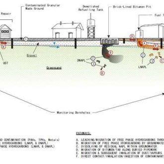
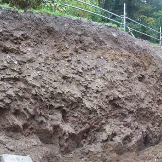
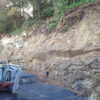
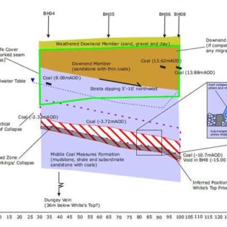
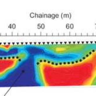
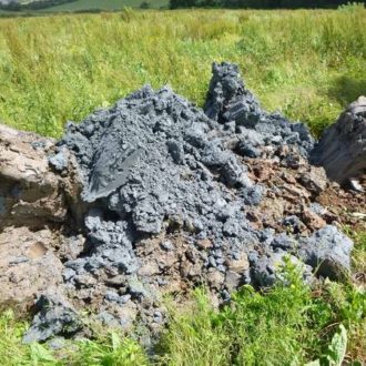
    The Somerset Levels typically comprise a thick sequence of Quaternary and Recent Alluvium/ Tidal Flat Deposits, made up of layers of peat, clay, silt, sand and gravel, underlain by Triassic and Jurassic bedrock deposits. The cost-effective development of residential housing can be difficult in this area of the country, due to the deep Alluvium/ Tidal Flat Deposits, often ranging between 10m and >20m in thickness, which sometimes results in piled foundations being the default foundation solution, which can often affect the viability of the project. 
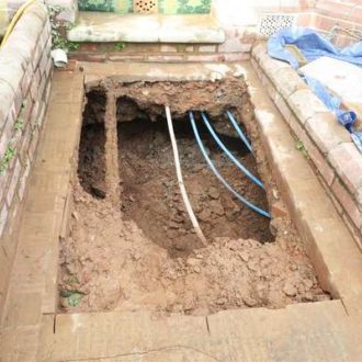
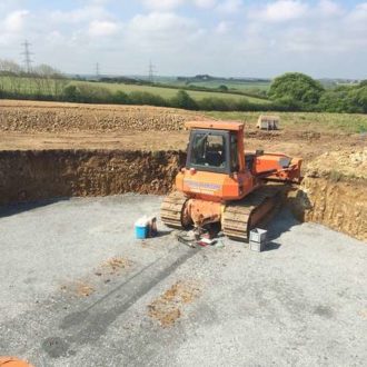
The upper 1.5m-2.0m of the Alluvium/ Tidal Flat Deposits often comprise desiccated clay soils and can, in some circumstances, provide a suitable founding stratum for shallow foundations. Conversely, for larger developments, ground improvement can also be considered to facilitate the use of shallow foundations, as a cost-effective alternative to piles. 
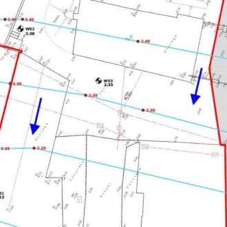
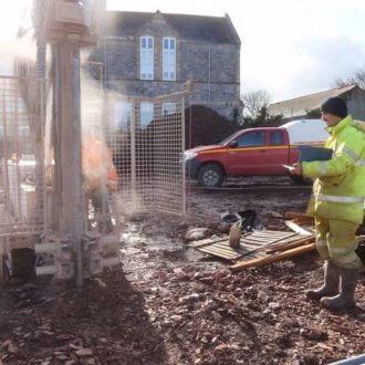
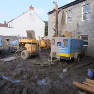
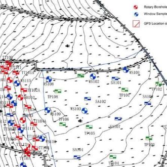
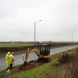
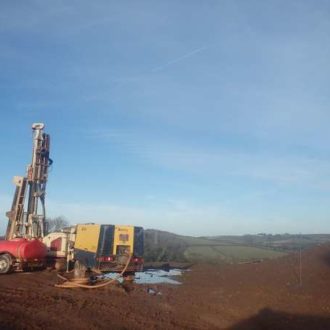
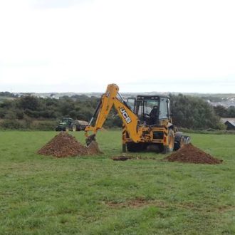
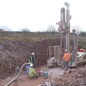
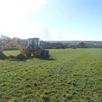
As part of a general ground investigation, Ruddlesden geotechnical have recently undertaken a foundation options appraisal in Weston-super-Mare for a proposed residential development, where all of the above were considered, to provide the most cost-effective solution for the developer. A mix of piled and strip/ trench-fill foundations were recommended, directly relating to the underlying geology.

  • 25-dudsbury-golf-course-1

    Pre-Purchase Phase 1 Geotechnical Assessment Provides Cost-Effective Information

    Ruddlesden geotechnical were commissioned to undertake a Phase 1 Geotechnical Assessment on behalf of a national housebuilder at an existing golf course in Dorset. Following a review of the desk study information and the consultation of historical maps, geological maps and memoirs, a walkover survey of the site was undertaken. This information allowed a ground model to be produced, which was used to identify the geotechnical risks and current uncertainties with regards to the proposed residential redevelopment of the site. The site was zoned, based on the anticipated ground conditions, and recommendations covering foundations, excavations, surface water drainage and slope stability were provided. The findings of the Phase 1 informed the scope of works for the Phase 2 deotechnical investigation and contamination assessment and ultimately provided the client with an understanding of the development constraints, opportunities and forecasted development costs for the site, prior to committing to the purchase of the site.

  • 23-cpt-ascot-reduced-1

    CPT Testing Used to Supplement Borehole Data

    Following an initial phase of geotechnical investigation, comprising cable percussive boreholes, cone penetration (CPT) testing was undertaken to obtain a greater resolution of data, to confirm the ground and groundwater conditions beneath the site. The testing caused minimal site disturbance, which was critical, as the site investigation works were being undertaken within the confines of a residential care home. The testing was also rapid, which allowed many locations to be undertaken within a day, meaning that any inconvenience caused to the residents was limited to a single day. Ruddlesden geotechnical commissioned an international contractor to undertake the testing and provided on site supervision and interpretation of the data, which was ultimately used to inform a foundation options appraisal.

  • 22-portland-2-reduced-1

    Rope Access Work for Cliff Stability Survey, Dorset

    Ruddlesden geotechnical were commissioned to undertake a cliff stability survey for a property situated on the Isle of Portland. In order for kinematic analyses to be undertaken, to inform the need for remedial (stabilisation) measures, rock mass data was required. Due to the inaccessibility of the limestone escarpment, rope access was required to obtain the necessary data. Ruddlesden geotechnical obtained the data under the supervision of IRATA-qualified personnel, who managed all of the health and safety aspects of the project.

  • 21-yannons-geophys-1

    Geophysics Provides Site-Wide Ground Profile Information, Devon

    Near-surface geophysics, comprising ground penetrating radar (GPR) and resistivity, was used to identify the presence, geometry and depth of limestone solution features at a proposed residential development site in Torbay. Following a soakaway test investigation, Ruddlesden geotechnical had concerns that the natural solution features within the limestone bedrock could inhibit the use of conventional soakaway drains at this site. Some conventional trial pitting and trenching had been undertaken with excavation plant, revealing a variable and often absent rock-head profile. Due to the variability and need to keep site disturbance to a minimum, geophysics was considered to be the most suitable method of investigation. Ruddlesden geotechnical have a good working relationship with a specialist team of geophysicists, who, under the instruction of Ruddlesden geotechnical, completed the works on this project. Following the geophysical survey and acquisition of the site, further geotechnical investigation was undertaken to confirm the profile (and depths) provided by the geophysics. The geophysics provided greater site coverage and certainty on the ground conditions, which were proven to be variable and potentially problematic.

  • 20-kingsbridge-1

    Groundwater Monitoring for Retaining Wall Design, Devon

    Following a geotechnical investigation, groundwater monitoring was undertaken to provide data for the design of a proposed retaining wall. Due to the site’s locality, near to a tidal estuary, monitoring visits were carefully considered, to ensure that the high tidal range, and the groundwater table’s response, was reflected in the data. The level of the groundwater table and groundwater pressures were critical to the retaining wall design. Limited data and/ or conservative assumptions could have resulted in the overdesign of the structure, with construction costs significantly more than they should have been.

  • 19-nansledan-gas-1

    Gas Monitoring for Residential Development in Cornwall

    Ruddlesden geotechnical have been undertaking ground gas monitoring to provide data for a ground gas assessmentfor the proposed residential development of land near Newquay, Cornwall. The Phase 1 Preliminary Contamination Assessment and mining risk assessmentidentified that an Elvan Dyke (coarse-grained igneous intrusion) had previously been quarried within the centre of the proposed development site and that the quarry had subsequently been used as a landfill site and infilled with domestic refuse. As part of the contaminated land assessment, ground gas monitoring wells were installed within windowless sample boreholes, to facilitate the long-term ground gas monitoring. Ruddlesden geotechnical use an infra-red gas analyser to monitor levels of carbon dioxide, methane, oxygen, carbon monoxide, hydrogen sulphide and gas flow.

  • 18-clay-wsm-lab-test-reduced-1

    UKAS Accredited Testing for Residential Development in Somerset

    Extensive geotechnical and contamination laboratory testing was recently undertaken as part of a ground investigation for proposed residential development site on the outskirts of Weston-super-Mare. In addition to classification (plastic and liquid limits and particle size distribution) tests, quick undrained triaxial and oedometer consolidation tests were carried out to provide information for foundation design. pH and soluble sulphate testing (BRE SD1 suite) was also undertaken to confirm the buried concrete class requirements. A broad range of contamination testing, including asbestos, heavy metals, polyaromatic hydrocarbons (PAH) and total petroleum hydrocarbons (TPH), was undertaken to provide information for human health and controlled waters risk assessments. The testing was UKAS accredited and Ruddlesden geotechnical’s close working relationships with both the laboratories helped ensure the testing results were issued promptly.

  • 17-yannons-2-reduced-1

    Sand Replacement Testing Undertaken to Validate Earthworks, Torbay

    Following the production of an earthworks specification, Ruddlesden geotechnical undertook in-situ sand replacement testing, to confirm the dry density of compacted material, and collected representative samples for geotechnical laboratory testing, to confirm the moisture content and suitability of the compacted material, to validate the deposition of materials during the construction of an embankment. The embankment was being constructed as part of a larger earthworks scheme, which formed the enabling works for a residential development in Paignton. Liaison with the groundworkers and client was key to the success of the earthworks. Delays in material placement, particularly during periods of inclement weather, can lead to excessive time delays and hence additional costs.

  • 16-wind-turbine-2-reduced-1

    Plate Bearing Testing for Wind Turbine, Devon

    Ruddlesden geotechnical have recently undertaken plate bearing testing at a number of farms in Cornwall to validate geotechnical parameters, provided as part of a previous geotechnical investigation, used in the design of the wind turbine. Ruddlesden geotechnical liaise with the client and construction team to undertake the testing as soon as excavation is complete, to ensure the ground to be tested is relatively undisturbed, representative and as not to delay the construction phase. Careful planning can allow other aspects of wind turbine construction, including crane pads and track ways, to be validated, to save time and ultimately construction costs.

  • 15-helston-cbr-reduced-1

    Highway Investigation Works Adjacent to Live Highway, Cornwall

    In-situ California Bearing Ratio (CBR) testing was undertaken to provide a design CBR value for road pavement design. The testing was to be undertaken within a highway verge of an existing A-road. Ruddlesden geotechnical obtained the necessary street works licence and organised the appropriate level of traffic management to protect site operatives. Trial pits were excavated within the verge to reveal the underlying subgrade. A number of Transport Research Laboratory (TRL) Dynamic Cone Penetrometer (DCP) tests were undertaken to ascertain the strength of the subgrade and, combined with UKAS accredited laboratory testing, calculate a representative CBR value for design.

  • 14-yannons-deep-bore-soakaway-testing-reduced-1

    Deep Bore Soakaway Testing, Devon

    A combination of in-situ constant and variable (falling) and constant head testing was undertaken to provide information for the design of a number of deep-bore soakaway drains at a residential development site in Torbay. Deep-bore soakaway drains had previously been recommended by Ruddlesden geotechnical following observations made during conventional soakaway testing in accordance with BRE DG 365. Previous geotechnical investigation and near-surface geophysics, undertaken as part of a solution feature investigation, had indicated that the use of conventional shallow soakaway drainscould lead to the wash-out of near surface soils through underlying cavernous limestone, potentially leading to an increased long-term subsidence risk of the ground. Rotary open-hole boreholes were undertaken to form the deep bore soakaway at depths specified by the consulting engineers, based on information provided by Ruddlesden geotechnical from an earlier phase of geotechnical investigation, which included a period of groundwater monitoring. Additional in-situ constant head permeability testing was also undertaken following the installation of the deep bore soakaways to verify the design parameters and to confirm the performance of the deep bore soakaways. All testing was undertaken in accordance with BS EN ISO 22282-2:2012.

  • 13-nansledan-3

    BRE DG 365 Soakaway Testing, Cornwall

    In-situ soakaway testing was undertaken in accordance with BRE DG 365, as part of a wider geotechnical investigation and contamination assessment for the residential redevelopment of land near Newquay, in Cornwall. The testing was undertaken using machine-excavated trial pits, with a tractor-towed water bowser used to provide the large volumes of water required for testing. Where practicable, Ruddlesden geotechnical use local plant hire firms and agricultural contractors for all of our ground investigation work. Ruddlesden geotechnical worked closely with the consulting engineers to ensure that sufficient information was provided for surface water drainage design. Due care was taken to appease local stakeholders, siting the test locations to minimise excessive disturbance to existing agricultural land and ensuring that all test locations were reinstated with the upmost care to mitigate against any future damage to agricultural plant and/ or livestock.

  • 12-glove-factory-reduced-2

    Boreholes for Retaining Wall, North Devon

    To aid the design of a large retaining wallat a former glove factory in North Devon, Ruddlesden geotechnical were commissioned to undertake a geotechnical investigation to provide information on the ground conditions. Combined percussive and rotary drilling was undertaken, to obtain sufficient samples of the near surface soils and deeper rock materials, which could not be readily sampled using percussive or rotary methods in isolation. Cost (and time) savings were made by only mobilising one drilling rig, rather than have undertaken separate phases of investigation for the sampling of soils and rock materials. Photograph of the completed project, courtesy of the architect – Woodward Smith.

  • 11-woolacombe-crane-reduced-1

    Rotary Borehole Rig Craned-In, in Devon

    Rotary cored boreholes were undertaken as part of a geotechnical investigation for the proposed retaining wall in North Devon. Restricted access meant that the drilling rig had to be craned onto the site. Cores of the rock were recovered and logged by our engineering geologist to confirm the strength, composition, and state and geometry of discontinuities within the bedrock, for use in the design of the proposed retaining wall, which was supporting a public highway and required to facilitate the development. Downhole geophysics was subsequently undertaken to provide further information on the fracture orientation and in-situ condition.

  • 10-radbrook-reduced-1

    Cable Percussive Boreholes for Piled Foundation Design and Settlement Analysis

    Cable percussive boring was undertaken as part of a geotechnical investigation to determine the ground profile for piled foundation design and assess the settlement of soft and compressible ground beneath a proposed embankment at the site of a proposed residential development in Shropshire. Cable percussive boring was considered the most suitable method for this project as they facilitated the recovery of relatively soft soils to depths of up to 20m, which could not have been achieved using dynamic sampling/ windowless sample boreholes, trial pits or conventional rotary boreholes. In addition to facilitating in-situ standard penetration tests (SPTs), the cable percussive boreholes allowed undisturbed samples to be taken for undrained triaxial and oedometer consolidation laboratory testing to be carried out, for foundation design and settlement analysis.

  • 8-coalpit-heath-reduced-1

    Trial Trenches Expose Historical Coal Mining Entries near Bristol

    A combination of trial pitting and trenching was undertaken at a site in an area of historical coal mining to the north of Bristol as part of a coal mining risk assessment. This exploratory technique was used to provide an indication of the natural ground conditions beneath the site, as well as to delineate historical mining features, including mine entries. The trial trenches and trial pits enabled a sufficient volume of the ground to be inspected and historical mining features to be identified and described by our engineering geologist, whilst maintaining a sufficiently safe distance from the historical mine entries.

  • 9-kingsbridge-2-reduced-1

    Dynamic Sampling was Preferred Method of Investigation in Devon

    Dynamic sampling (windowless sample boreholes) was utilised in a scheme of works for the proposed stabilisation and reinstatement of a quay wall. This was the preferred method for the initial geotechnical investigation at this site, as they allowed representative samples of the near surface soils to be obtained, facilitated Standard Penetration Tests (SPTs) and were able to be progressed down to depths of 6m-8m to determine the presence of engineering rock-head, all whilst keeping site disturbance and the areal extent of the site works to a minimum, allowing the adjacent car park to be in continued use without the need for closure. On completion of the ground investigation, the boreholes were either installed with monitoring wells, to facilitate long-term groundwater and/ or ground gas monitoring, or backfilled with natural arisings prior to reinstatement.

  • 24-yannons-geotechnical-consultancy-1

    Combined Geotechnical Consultancy Services Provided for Residential Development, Devon

    Ruddlesden geotechnical has provided a combination of several geotechnical consultancy services for a large and on-going residential development site in Torbay. The geology of clay underlain limestone has resulted in a number of geotechnical hazards, primarily associated with solution features in the limestone, which have had implications on foundations, drainage and excavations. Using information obtained from a combination of geophysics, trial pits, dynamic sampling/ windowless sample boreholes and rotary boreholes, foundation recommendations have locally included reinforcement and widening to reduce ground bearing pressures. Deep bore soakaways have been recommended to avoid the potential wash-out of near surface soils, which might be caused by conventional soakaways in these ground conditions. In addition, terracing of a slope in part of the site generated significant quantities of soil. Rather than disposing of this at landfill, a material re-use suitability assessment was undertaken, which allowed an earthworks specification to be produced, which itself enabled ground levels to be raised on another area of the site, reducing the need to mechanically break-out near-surface bedrock for excavations.

  • 7-nansledan-1

    Multiple Ground Investigation Techniques on Site in Cornwall

    A combination of trial pits and dynamic sampling (windowless sample boreholes)with in-situ and laboratory testing has been undertaken as part of an ongoing ground investigation for a large residential development on the outskirts of Newquay, in Cornwall. The trial pits have allowed in-situ soakaway testing to be undertaken in accordance with BRE DG 365, to provide information for surface water drainage design. The boreholes have allowed in-situ standard penetration testing (SPTs) to be carried out, to provide information for foundation and retaining wall design. The boreholes have also been used to install monitoring wells for long-term gas monitoring. Both the trial pits and boreholes have been used to obtain representative samples for both contamination and geotechnical assessment purposes, which has included earthworks testing for the re-use of site-won soils. Ruddlesden geotechnical’s knowledge of the ground conditions on this site has enabled the most suitable and cost-effective method of investigation to be used.

  • AGS
  • Constructionline
  • CSCS
  • SMAS
  • ECFC trust