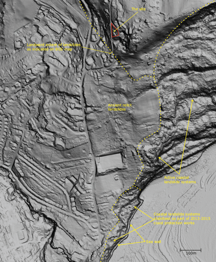
LiDAR data is a fantastically useful and freely-available resource that can be used as part of slope stability assessments.
At this site in West Dorset, where a slope stability assessment was required as part of the planning process, the LIDAR imagery, with some interpretation, told most of the good news story.
Assessments such as this are carried out with confidence by our own in-house expert, Geoff Davis, who can never resist an opportunity to reference one or more of his papers on the subject!